

The CTA map index was researched and devised by Roy Benedict and Bob Heinlein. Thanks to both these gentlemen, we are able to benefit from the hard work and dedication.
Dates on Pre-CTA maps have been gathered from research of the printed map itself as well as information from experts.
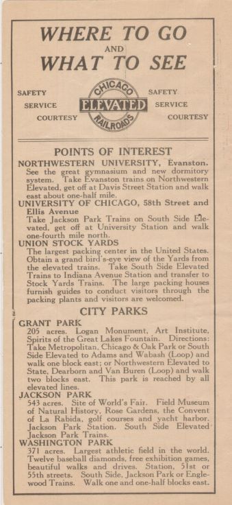
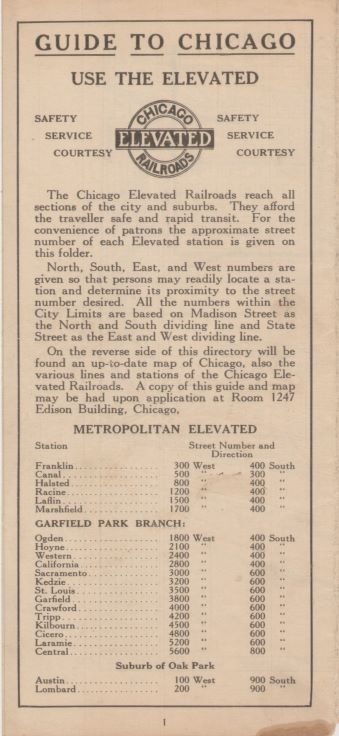
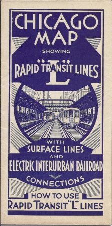
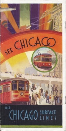
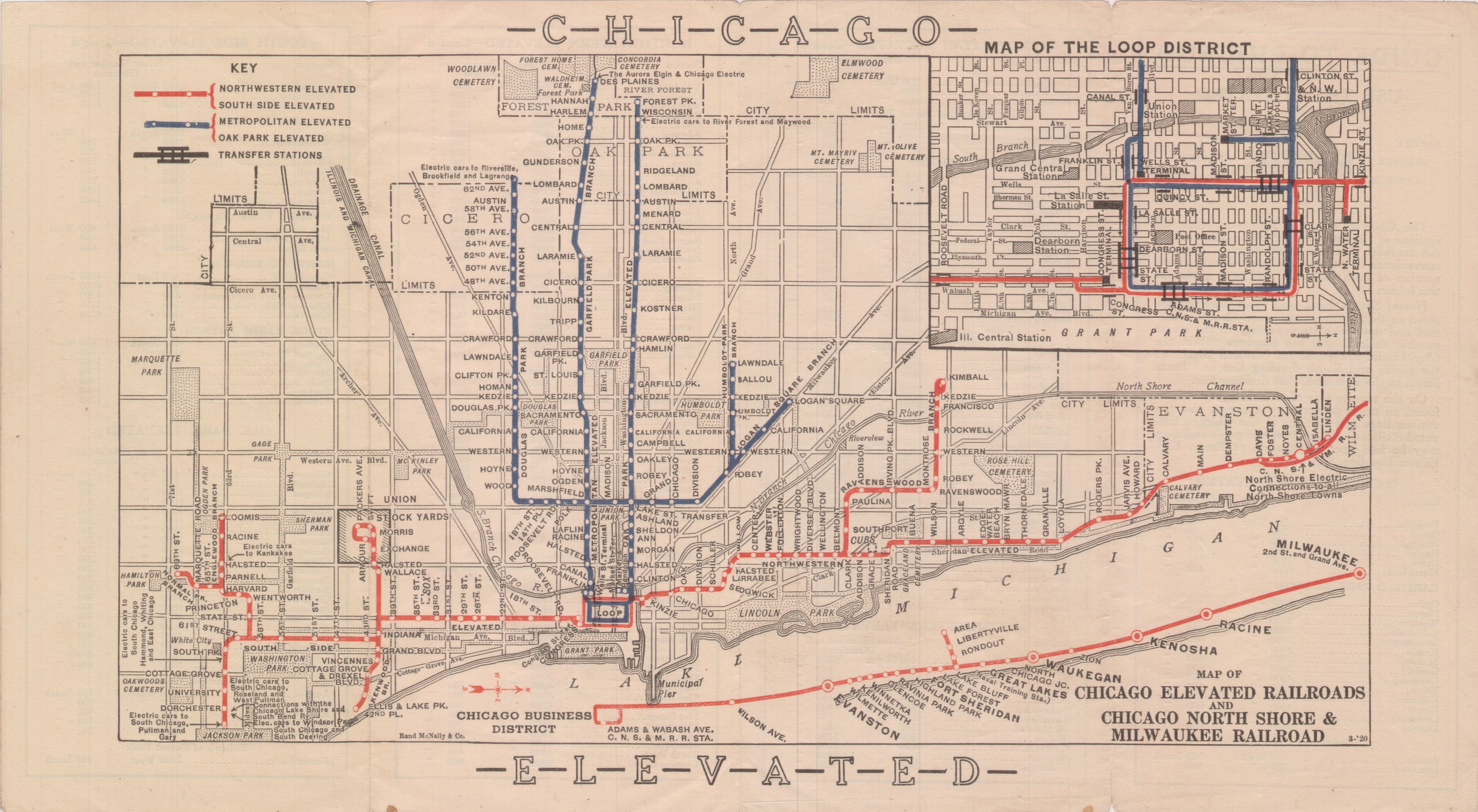
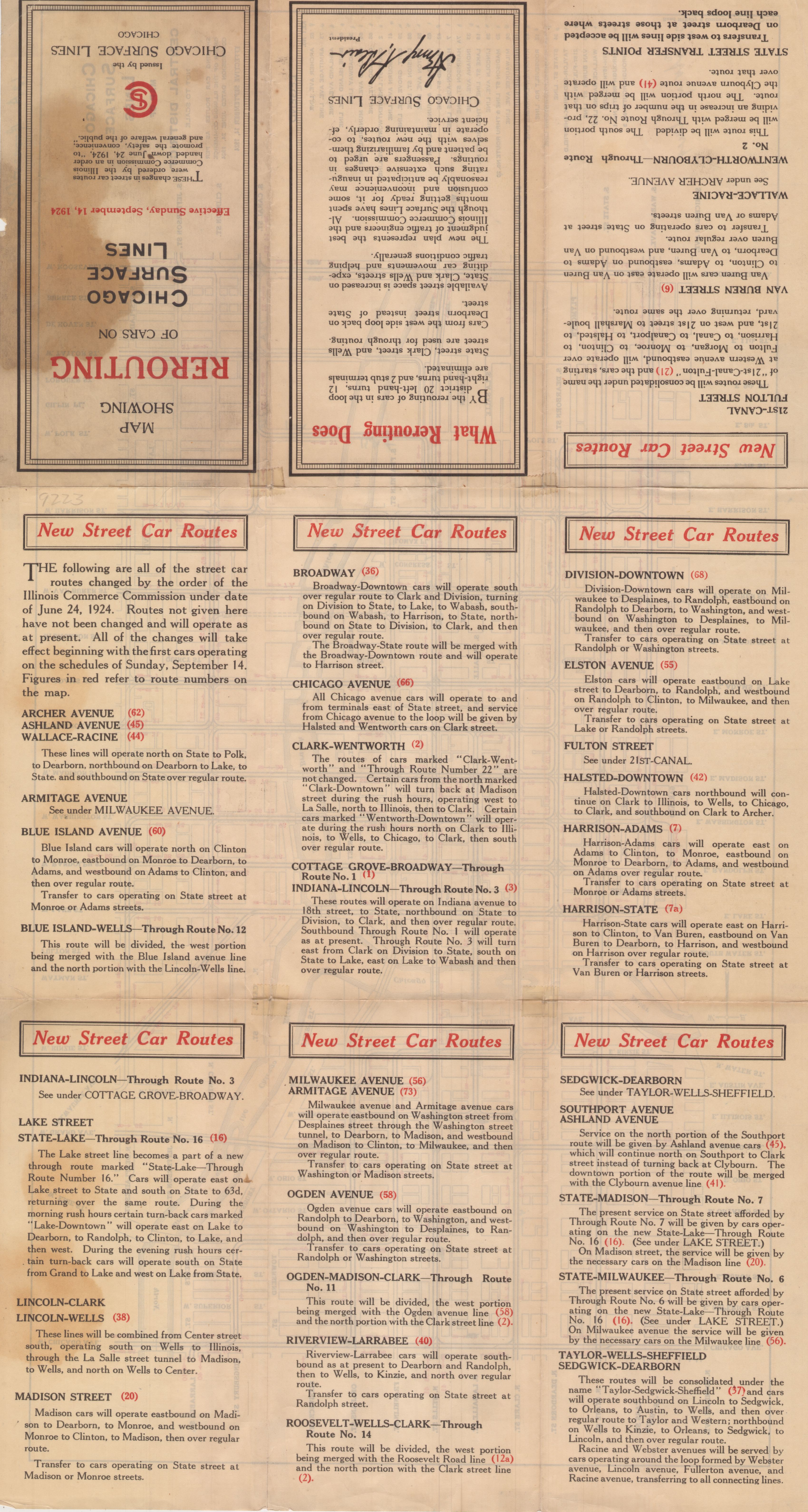
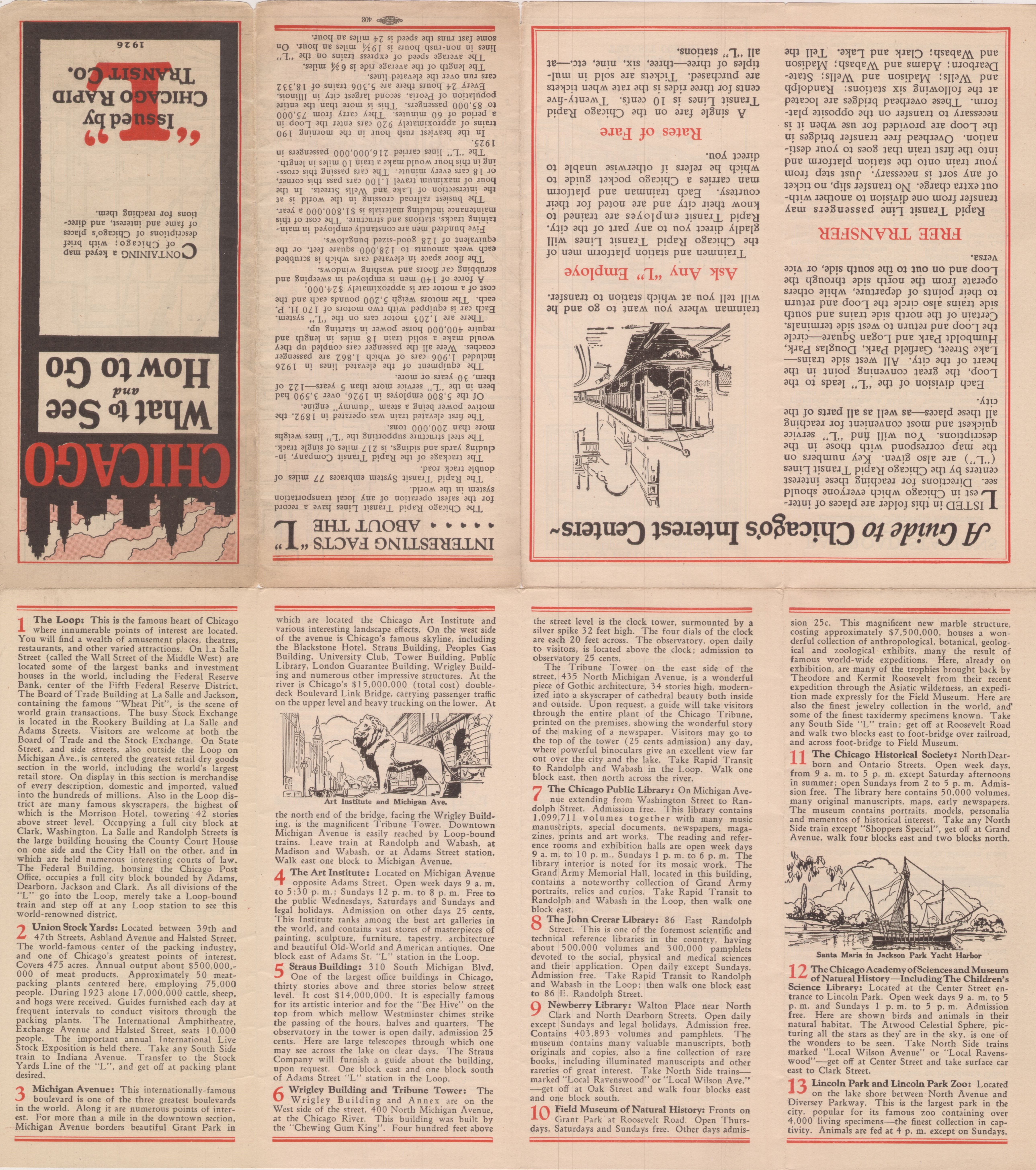
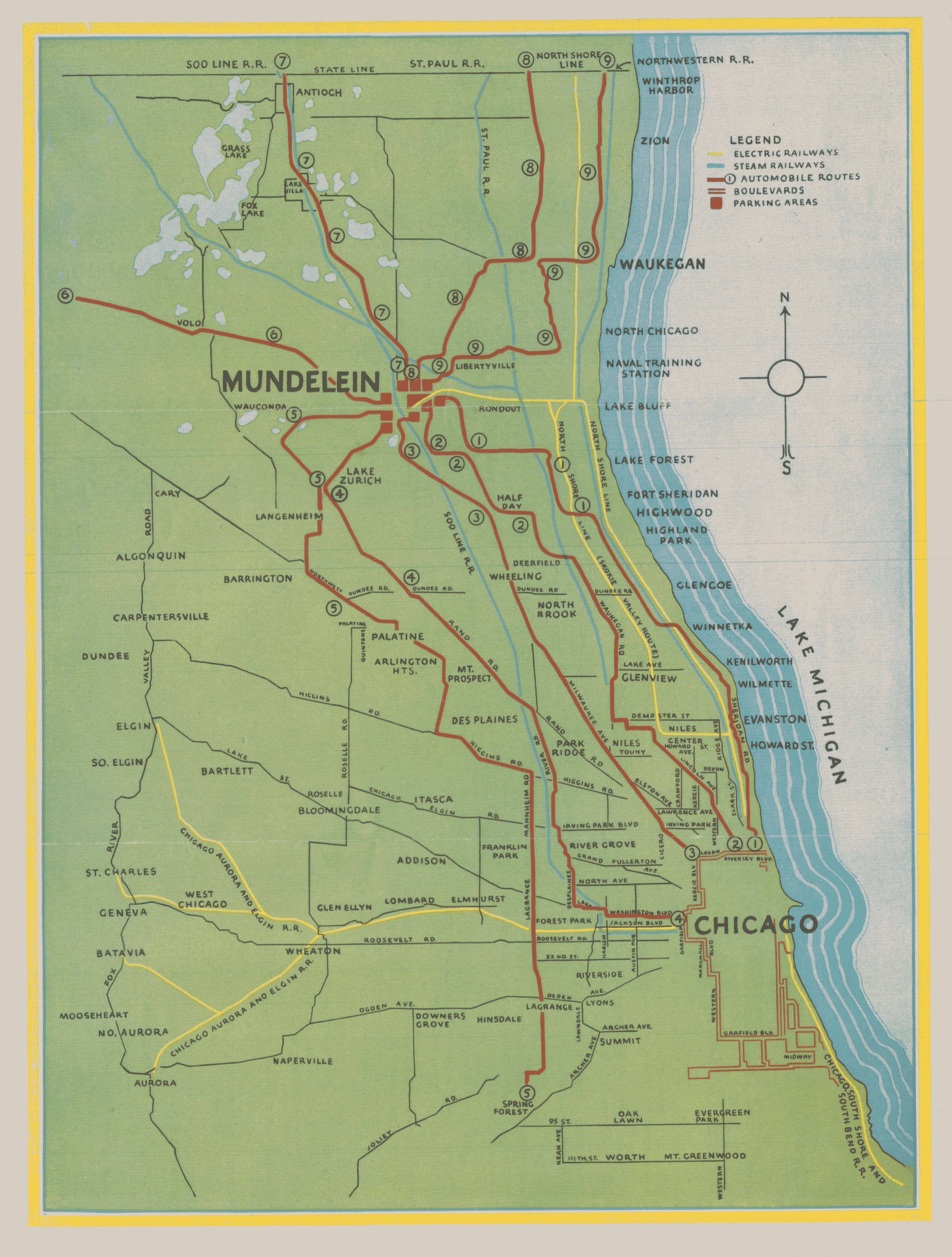
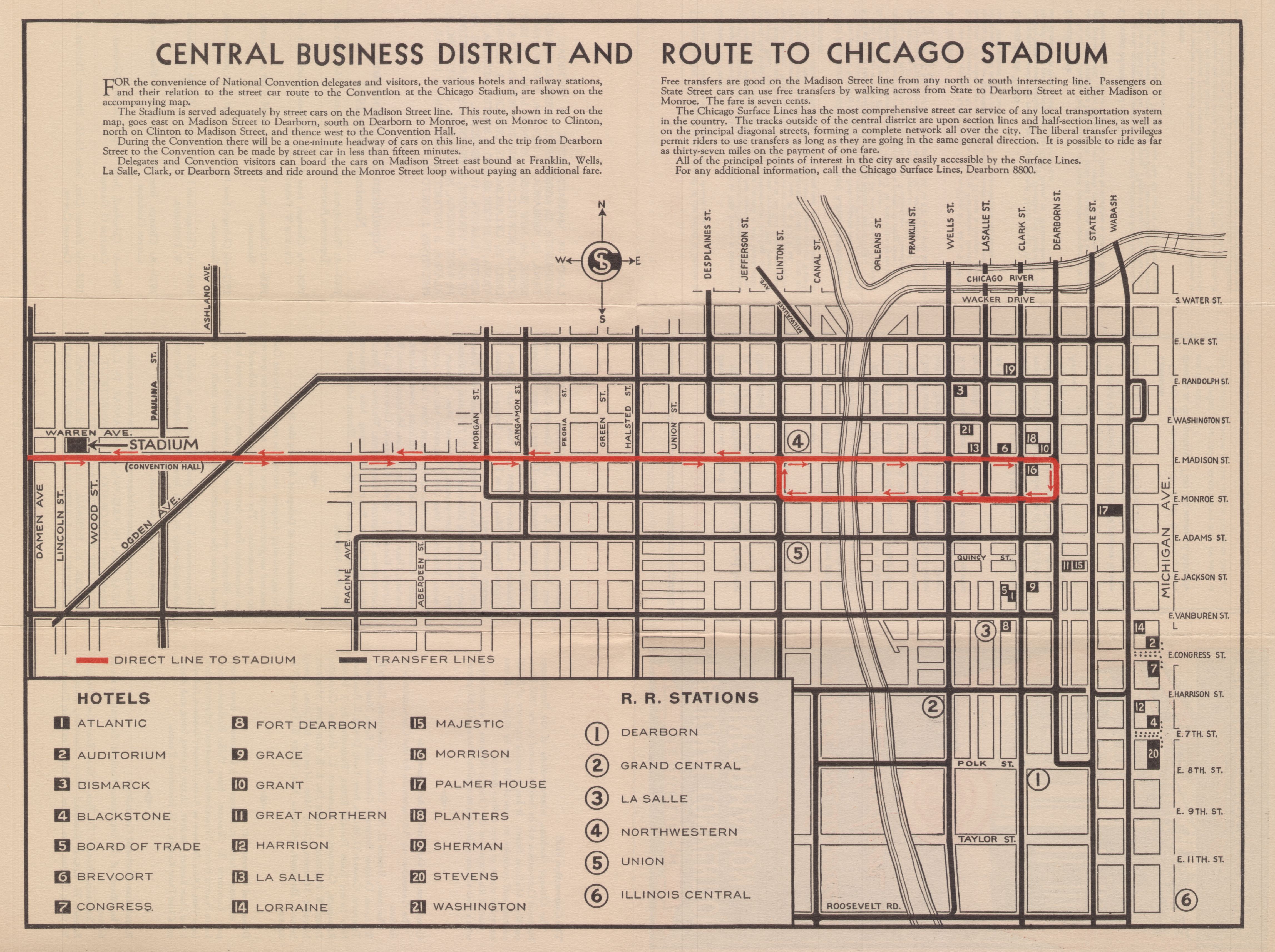
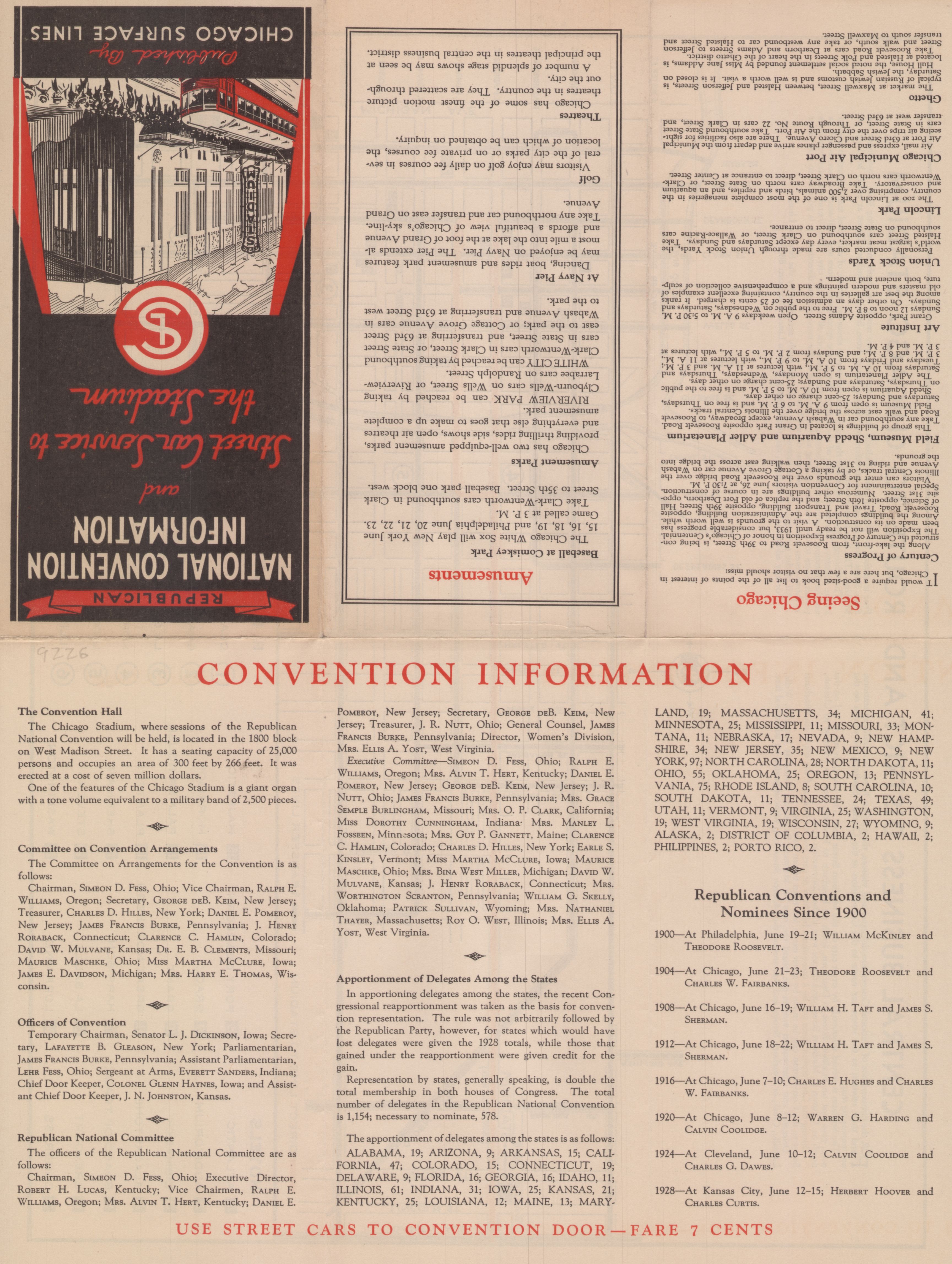
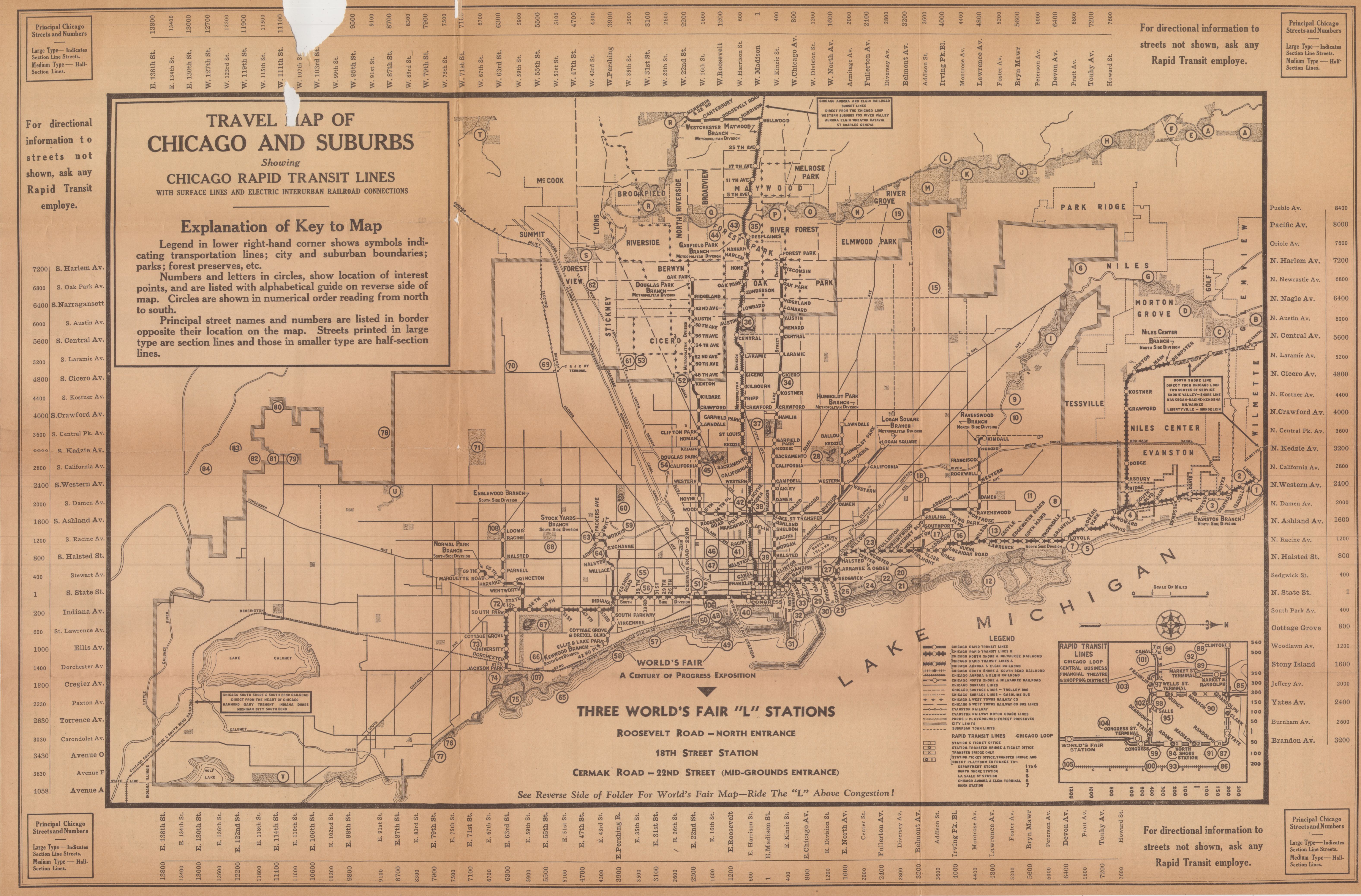
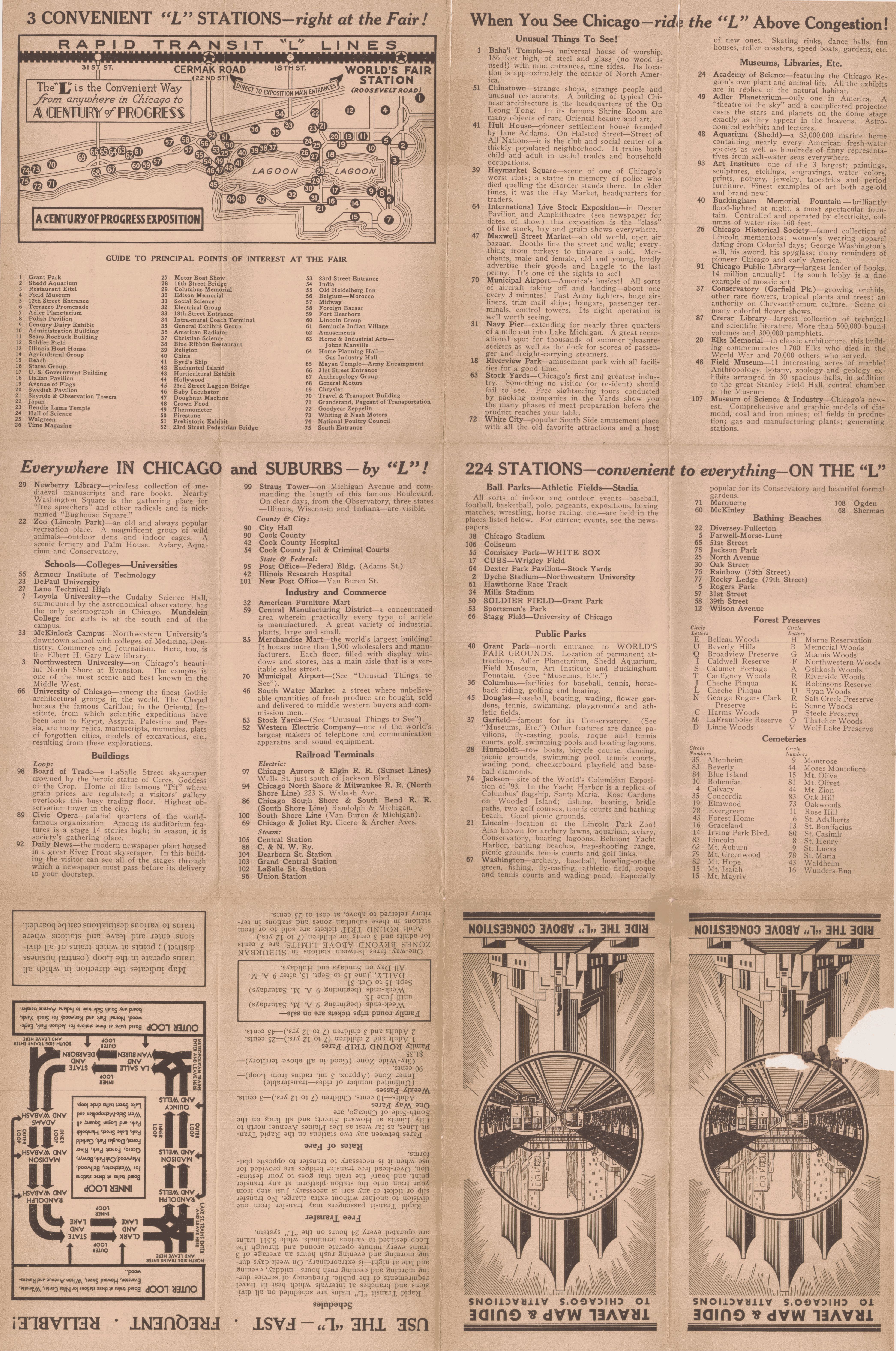
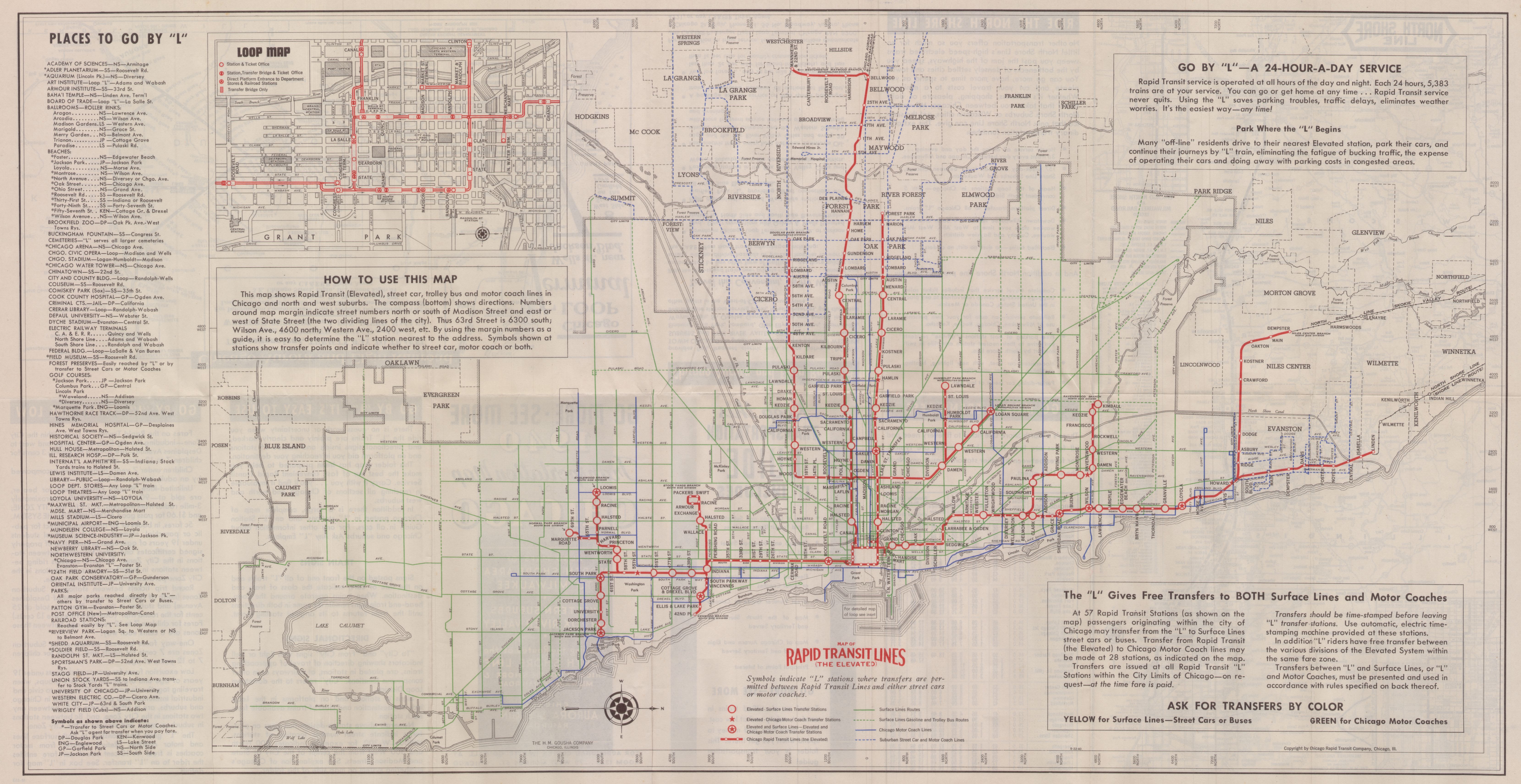
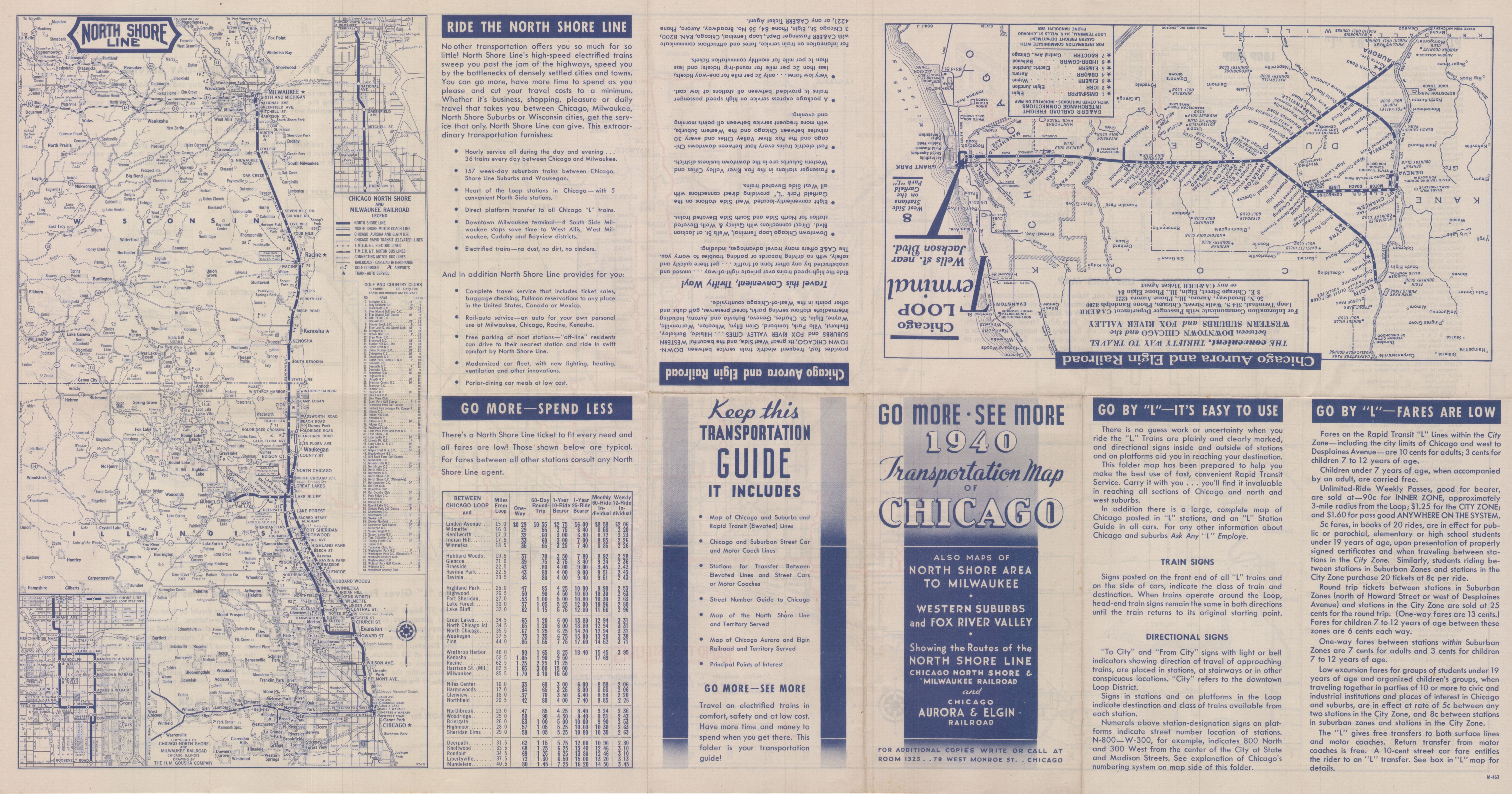
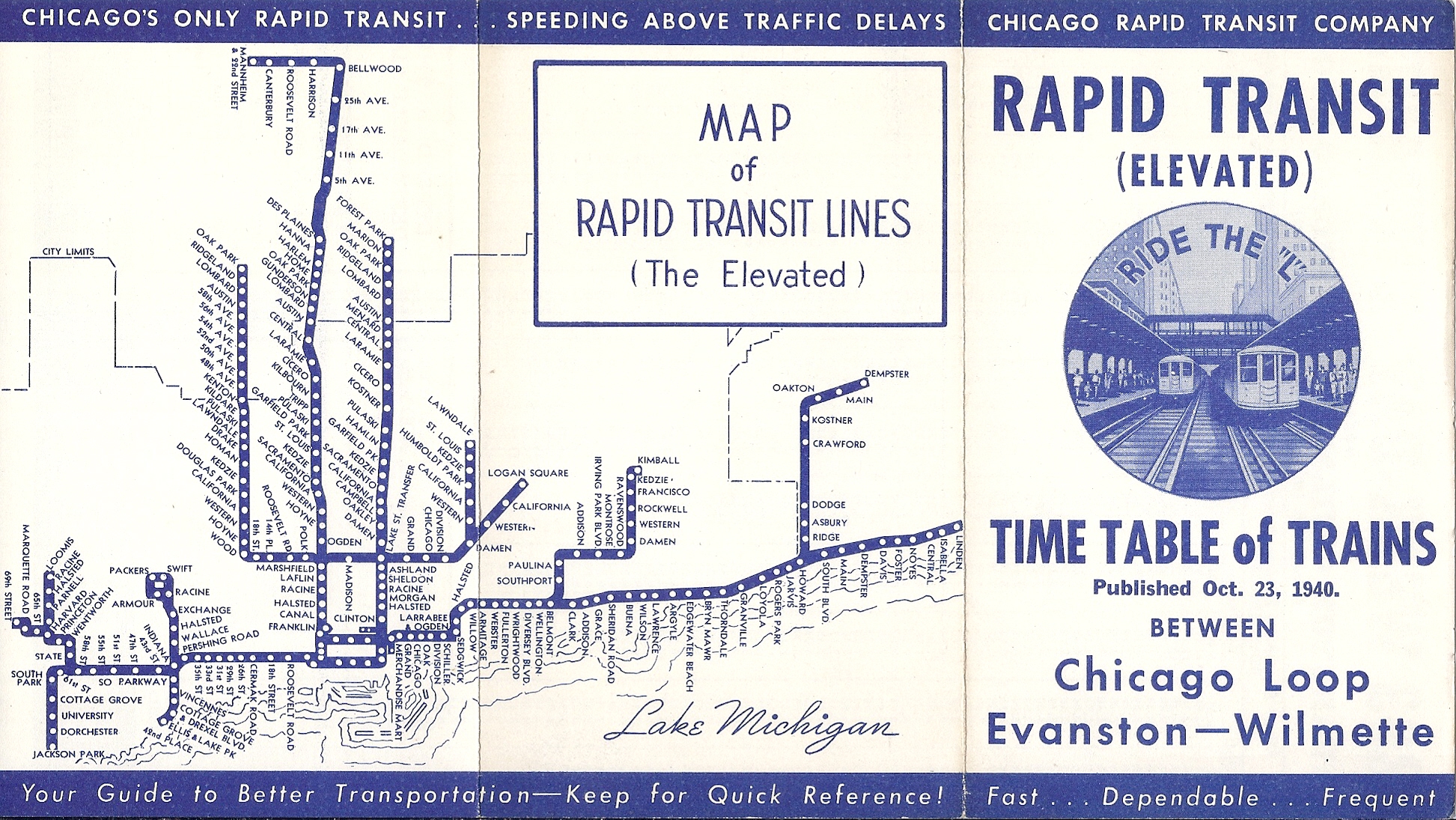
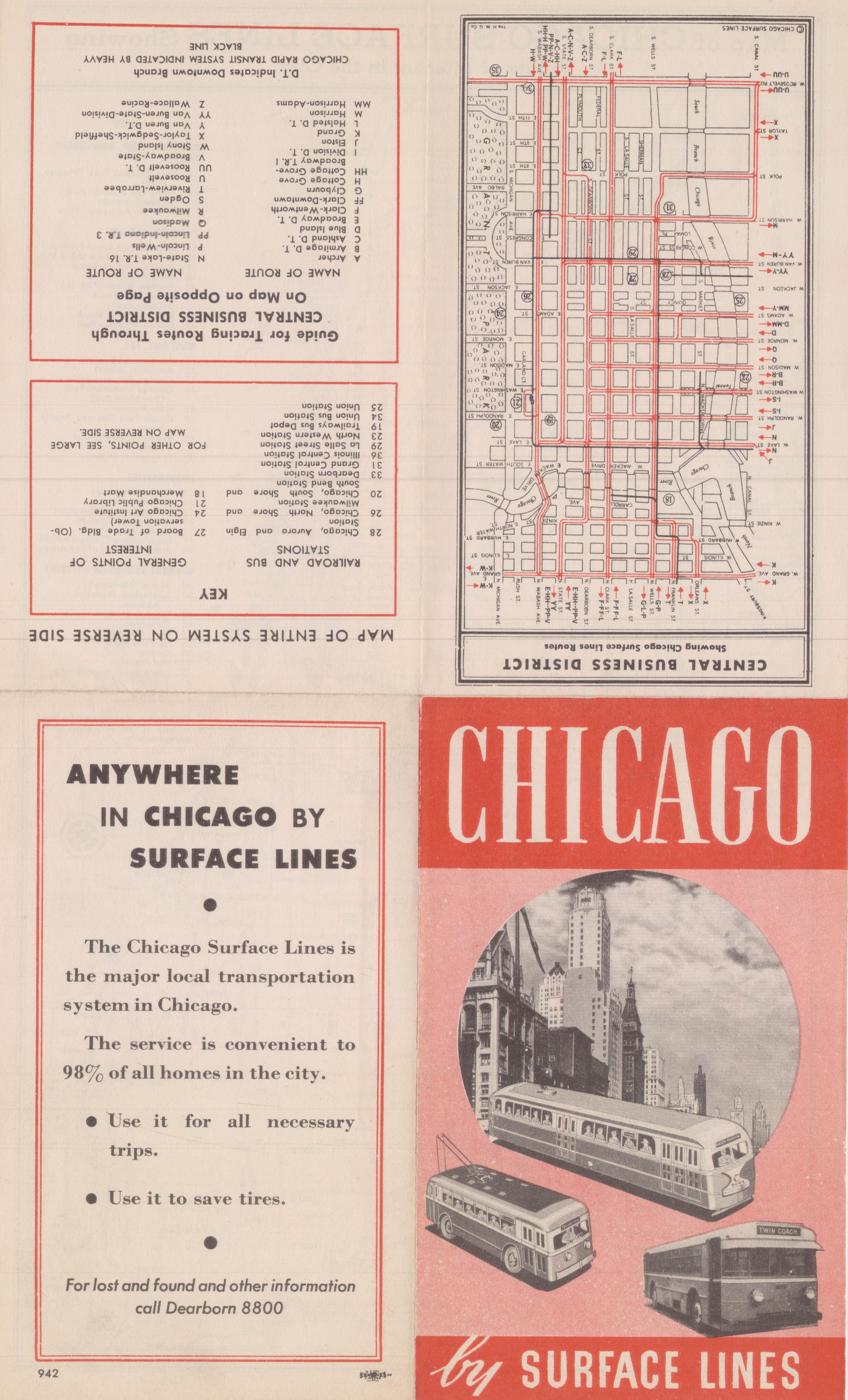
"Front Page" is identified as the side with the major map. "Back Page" is the opposite side. Some map files are quite large (up to 15 mb). They may take a while to load depending on your internet connection speed.
Click here for the FULL MAP/DOCUMENT
Click here for the Front Page of the FULL MAP
Click here for the Back Page of the FULL MAP
COMP.jpg)
Click here for the Front Page of the FULL MAP
Click here for the Back Page of the FULL MAP
Click here for the FULL MAP/DOCUMENT
Click here for the Front Page of the FULL MAP
Click here for the Back Page of the FULL MAP
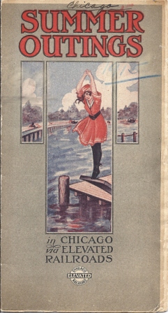
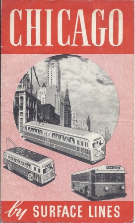
The "Cover" and "Inside Cover" may have originally been attached to the other pages.
Click here for the Cover
Click here for the Inside Cover
Click here for the Front Page of the FULL MAP
Click here for the Back Page of the FULL MAP
Click here for the Front Page of the FULL MAP
Click here for the Back Page of the FULL MAP
Click here for FULL MAP BOOKLET
Click here for the Front Page of the FULL MAP
Click here for the Back Page of the FULL MAP
Click here for the Front Page of the FULL MAP
Click here for the Back Page of the FULL MAP
Click here for the Front Page of the FULL MAP
Click here for the Back Page of the FULL MAP
Click here for the Front Page of the FULL MAP
Click here for the Back Page of the FULL MAP
Click here for the Front Page of the FULL MAP
Click here for the Back Page of the FULL MAP
Click here for the FULL Document
Click here for the Front Page of the FULL MAP
Click here for the Back Page of the FULL MAP
Click here for the Front Page of the FULL MAP
Click here for the Back Page of the FULL MAP
Click here for the Front Page of the FULL MAP
Click here for the Back Page of the FULL MAP
Click here for the Front Page of the FULL MAP
Click here for the Back Page of the FULL MAP
Click here for the Front Page of the FULL MAP
Click here for the Back Page of the FULL MAP
Click here for the Front Page of the FULL MAP
Click here for the Back Page of the FULL MAP
Click here for the Front Page of the FULL MAP
Click here for the Back Page of the FULL MAP
Click here for the FULL DOCUMENT
Click here for MAP INSERT
Click here for the FULL DOCUMENT
Click here for MAP INSERT
Click here for the Front Page of the FULL MAP
Click here for the Back Page of the FULL MAP
Click here for the Front Page of the FULL MAP
Click here for the Back Page of the FULL MAP
Click here for the Front Page of the FULL MAP
Click here for the Back Page of the FULL MAP
Click here for the Front Page of the FULL MAP
Click here for the Back Page of the FULL MAP
Click here for the Front Page of the FULL MAP
Click here for the Back Page of the FULL MAP
Click here for the Front Page of the FULL MAP
Click here for the Back Page of the FULL MAP
Click here for the Front Page of the FULL MAP
Click here for the Back Page of the FULL MAP
COMP.jpg)
Click here for the Front Page of the FULL MAP
Click here for the Back Page of the FULL MAP
COMP.jpg)
Click here for the Front Page of the FULL MAP
Click here for the Back Page of the FULL MAP
COMP.jpg)
Click here for the FULL DOCUMENT
Click here for the MAP INSERT/FOLD OUT (North Section)
Click here for the MAP INSERT/FOLD OUT (South Section)
Click here for the Front Page of the FULL MAP
Click here for the Back Page of the FULL MAP
Click here for the Front Page of the FULL MAP
Click here for the Back Page of the FULL MAP
Click here for the Front Page of the FULL MAP
Click here for the Back Page of the FULL MAP
Click here for the FULL DOCUMENT
Map insert is still stapled and we don't want to ruin the integrity of the original document in our collection.
Click here for the Front Page of the FULL MAP
Click here for the Back Page of the FULL MAP
Click here for the Front Page of the FULL MAP
Click here for the Back Page of the FULL MAP
Click here for the Front Page of the FULL MAP
Click here for the Back Page of the FULL MAP
Click here for the Front Page of the FULL MAP
Click here for the Back Page of the FULL MAP
Click here for the Front Page of the FULL MAP
Click here for the Back Page of the FULL MAP
Click here for the Front Page of the FULL MAP
Click here for the Back Page of the FULL MAP
Click here for the Front Page of the FULL MAP
Click here for the Back Page of the FULL MAP
Click here for the Front Page of the FULL MAP
Click here for the Back Page of the FULL MAP
COVER.jpg)
Click here for the Front Page of the FULL MAP
Click here for the Back Page of the FULL MAP
Click here for the Front Page of the FULL MAP
Click here for the Back Page of the FULL MAP
COMP.jpg)
Click here for the Front Page of the FULL MAP
Click here for the Back Page of the FULL MAP
Click here for the Front Page of the FULL MAP
Click here for the Back Page of the FULL MAP
-COMP.jpg)
.jpg)
.jpg)
.jpg)
_Front.jpg)
_Rear.jpg)
.jpg)
.jpg)
.jpg)
.jpg)
.jpg)
.jpg)
.jpg)
.jpg)
2.jpg)
2.jpg)